Max Patch Hiking Trail 2023
In TN or NC?
Max Patch Hiking Trail sits on the border of Tennessee and North Carolina. However, the summit is in North Carolina. It’s popular for wildflowers and views!
The Hike
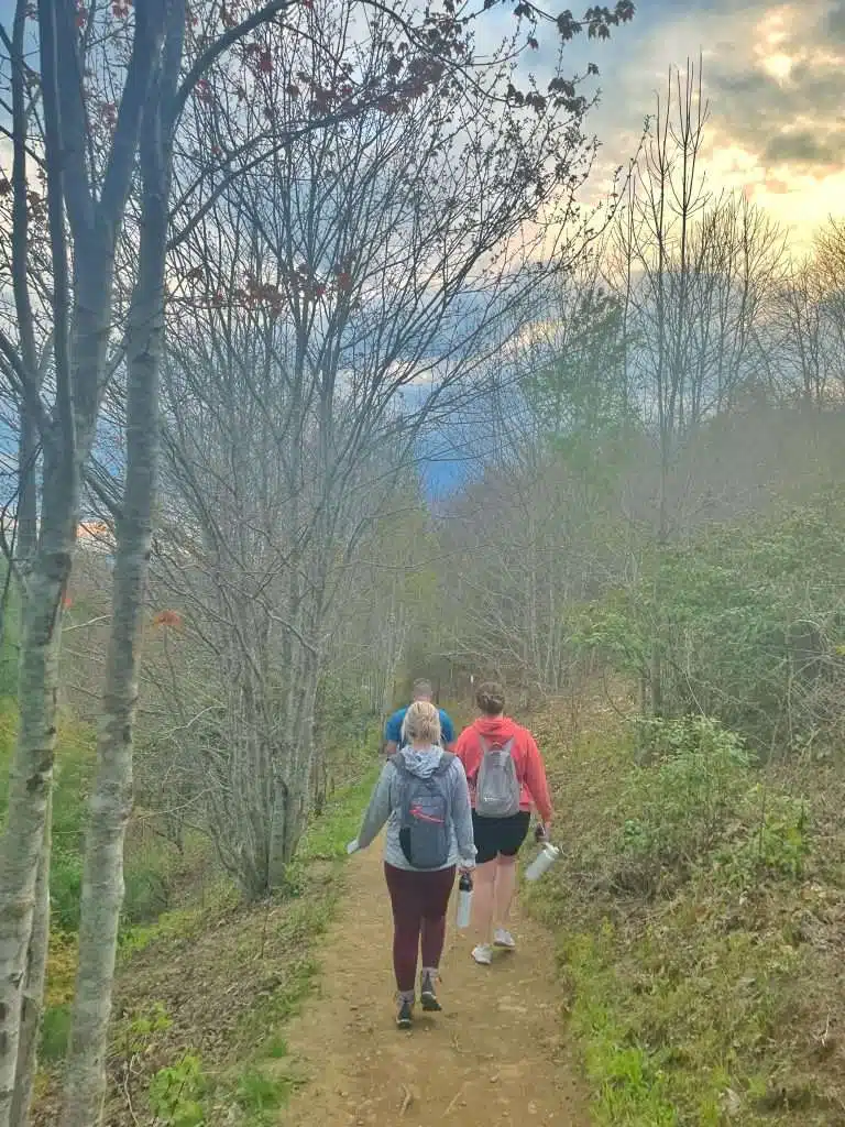
Max Patch hiking trail is relatively easy. It is a loop trail, and the entire thing is 1.5 miles long. As you start the hike you will come to the map, from there you can start the trail on either side. Most people start to the left because it’s an easier climb, as the sign says.
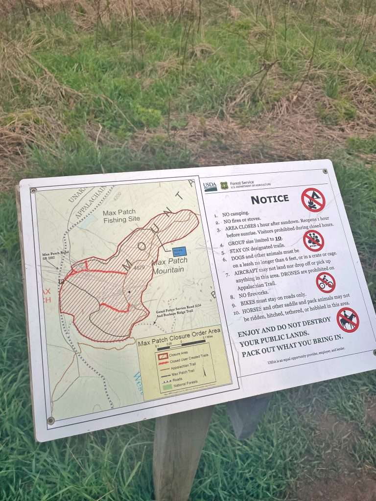
You will also walk part of the Appalachian trail during this hike. As you come up the trail (if you start to your left) you will see a map that shows which part is the Appalachian trail and which part is the Max Patch trail. You will also see the rules posted on this sign.
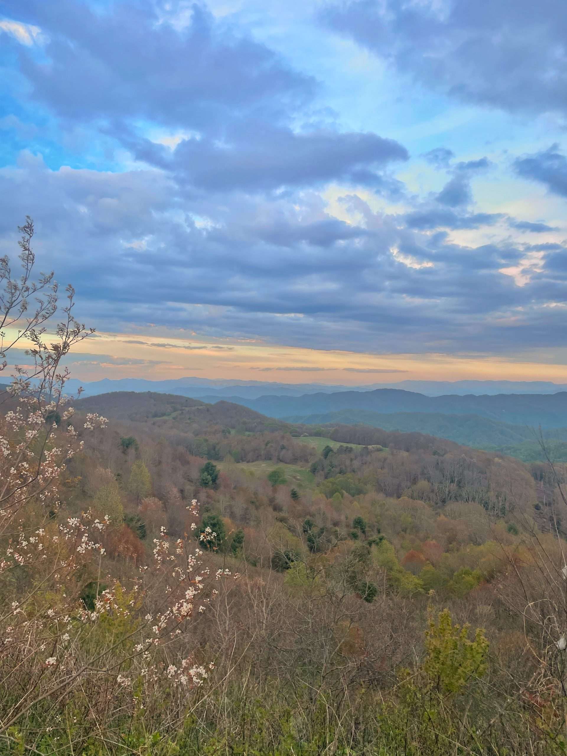
Around that sign is where you will see your first views of the mountains. Keep going to the summit! They get even more beautiful.
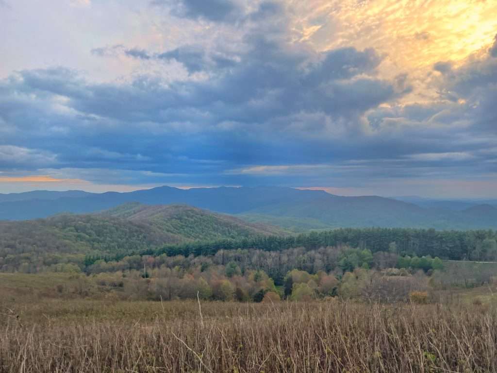
On your hike back down from the summit, don’t go back the same way you came. Remember, it is a loop trail so if you came up on the left side, go down on your right side. That is the way we did it and I highly recommend doing it that way. The hike down had many steps and it would be a lot more difficult to come up that way. On your way down, go slow and take in the views. It is so pretty, and much prettier than your hike up to the summit.
The Summit
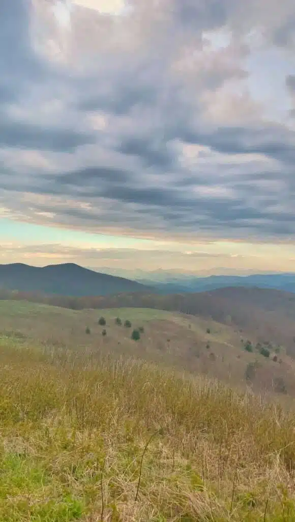
Once you reach the summit you are greeted by beautiful views! There are 360° views of mountains all around you. The mountains seen are: Bald Mountains, The Unakas, The Great Smoky Mountains, The Great Balsams, and The Black Mountains.
As of July 2021 there is a two year camping closure on Max Patch. It is currently set to expire on June 30, 2023 and as of June 13, 2023 it has not been extended. Along with the camping closure, a new set of rules were released. You can see them in a picture next to this text. The Pisgah National Forest had to implement these rules because of damage to the wildlife habitat.
Max Patch has always been a popular place for picnics, and I can see why. I was in awe of the gorgeous views! There is plenty of space to spread out from other people and feel as though you are the only group there.
Getting There
As with most hiking trails, it can be difficult to find the parking area. If you’re coming from Tennessee, you will go through the Gorge. Regardless of which way you’re coming, if you’re on I-40 take the Harmon Den exit. After you take the exit, turn onto Cold Springs Road. It turns to a gravel road and you’re on it for a little over 6 miles. I wouldn’t say a four-wheel drive vehicle is absolutely necessary to get here when it’s dry outside, but if you have the option take one.
For the GPS Google the address for Max Patch Parking. It’s not an actual address and will only say Del Rio, TN 37727. Tap directions and use it. That’s what we used and it took us directly to the parking area.
Remember to Leave No Trace!
Max Patch hiking trail is one of the easiest trails to do around this area. The summit is very popular for sunrises and sunsets! It was used as pasture in the 1800’s. Please stay on the trails and carry your trash out with you so many more can enjoy it for generations to come.
Max Patch hiking trail is close to Hot Springs, NC and Asheville, NC. Please reach out to me if you’re unsure of other things to do in the area.